-
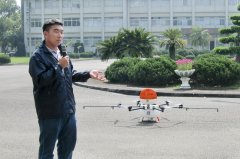
Agricultural drones have wide applications, excelling at spraying, fertilizing and disaster surveying
Nowadays drones are being used more and more widely, and they are also used in agriculture. Let's take a look together. Unmanned aerial vehicles are seen as a promising new capable assistant for the future development of agriculture. Not only has the Civil Aeronautics Administration been busy drafting regulations, under which anything above 250 grams will in future require real-name registration, but all sectors are also actively investing in developing agricultural and other uses of drones. The Agricultural Research Institute of the Council of Agriculture, Executive Yuan, has set up a drone team and is currently building experimental data; in future it is expected to establish a set of operating manuals for farmers to refer to.
-
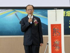
Agricultural drone applications and development prospects, agricultural aviation drones carrying out aerial photography missions
Guan Lihao said that at this stage he hopes to postpone the retirement of manned aircraft, and even more looks forward to purchasing new manned aircraft as soon as possible to make up for the future shortfall in flight capacity and continue recording changes in Taiwan's terrain. On the 7th, the Aerial Survey Office of the Forestry Bureau under the Council of Agriculture held a domestic
-

Why the Road to the Development and Popularization of Agricultural Drones Is Not Smooth
China has always been a major agricultural country. As of last year, the agricultural population accounted for about 48% of the total population, and after drones went through the military market and commercial market, many drone companies have set their sights on the agricultural market as a new opportunity. Theoretically, agricultural drones
-
Beginner's Guide to Agricultural Drone Aerial Photography: Making Field Patrols and Seedling Checks Easier
Agricultural drone aerial photography has become a great helper for field patrols. This article introduces the use of drones in farmland inspection, post-disaster surveys, and growth monitoring, as well as the self-study steps of simulator practice, on-site flying, and image interpretation, plus flight precautions, helping growers master the aerial perspective.
条件筛选