Computers Turn Weather Data into a Farming Helper, Farmers No Longer Just Look to the Sky for Their Livelihood
Text / Council of Agriculture
A Farmer's Good Helper - the Agrometeorological Advisory System
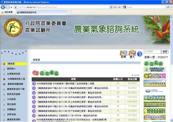
Farmers growing crops often need meteorological data as a reference for fertilizing, spraying and harvest dates. The Taiwan Agricultural Research Institute (TARI) of the Council of Agriculture has developed the "Agrometeorological Advisory System" (website: http://amis.tari.gov.tw/), which provides interactive on-screen query functions through web maps. Farmers can query the location of the nearest weather station and its meteorological information according to the location of their planting site, and use the agrometeorological forecast as a farming reference, meeting farmers' need for meteorological information.
TARI stated that the system provides a user-friendly query function for regional and areal meteorological data. Farmers only need to click on their location on the Google map platform, and through geographic information system computation they can obtain real-time local meteorological information. Although natural disasters caused by climate are very difficult to predict, the system uses long-term historical meteorological data and statistical analysis to let users become alert to the possibility of disasters based on past disaster occurrence probability, so that they can take precautions.
Taking the cultivation and management of fruit trees as an example, fruit growers can use the Agrometeorological Advisory System to query the meteorological data of the weather station nearest to their orchard's location. If there is no weather station near the orchard, the system will automatically search for a closer weather station and, through geographic information spatial computation, obtain the meteorological data for that orchard. Using the real-time meteorological data and the meteorological forecast data for the next 7 weeks that they query, farmers can use them as a reference for management operations such as irrigation, fertilization, spraying, bagging and harvesting.
The meteorological data of the "Agrometeorological Advisory System" is mainly provided by the Central Weather Bureau. At present, about 534 automatic stations transmit data to the database in real time through automatic connections, while non-automatic stations are regularly updated by manual download, in order to ensure the timeliness and completeness of the system's meteorological data. Among them, the daily meteorological data of the 17 first-level stations and 18 self-established weather stations of the agrometeorological observation network in the database can be downloaded.
Farmers can also apply to become members. The system will regularly send customized meteorological reports exclusively for members, and will also proactively issue warnings when the probability of meteorological disasters exceeds a critical value, so that farmers can immediately take preventive measures, such as activating sprinkler systems to lower orchard temperatures and reduce fruit drop and sunburn disease caused by high temperatures.
The system also provides various query functions and information services, such as long-term climate trends for each region, meteorological disaster prevention techniques and unit conversion, the origin of the 24 solar terms, meteorological proverbs, the farmers' almanac, and meteorological data for each solar term. TARI welcomes all sectors to make good use of it.
Agrometeorological Advisory System website: http://amis.tari.gov.tw/