Farmland Inventory Platform Officially Launches Today: Illegal Factories and Farmhouses Have Nowhere to Hide
Following the release of the farmland inventory results earlier this month, the Council of Agriculture today once again published the "Agricultural and Farmland Resource Inventory Results Query Map Platform." The platform overlays tens of thousands of land registry records, aerial photographs and current actual use information from the Agricultural Research Institute; with just a click, users can query the distribution of agriculture, forestry, fishery and livestock industries, and clearly identify the locations of illegal uses such as unauthorized factories. Besides serving as the basis for future national land zoning, the Council of Agriculture also urges the public to use the map platform to check for illegal structures, reporting any violation immediately via the APP, so that the power of the public can take part in oversight.
Click on an area on the map and it will display the current use, zoning and category of that area. For example, clicking on "Plot No. 2404, Xinan West Section, Wuri District, Taichung City" shows an illegal factory in a "Specially Designated Agricultural Zone." The red areas in the image below are all "factories" on agricultural land.
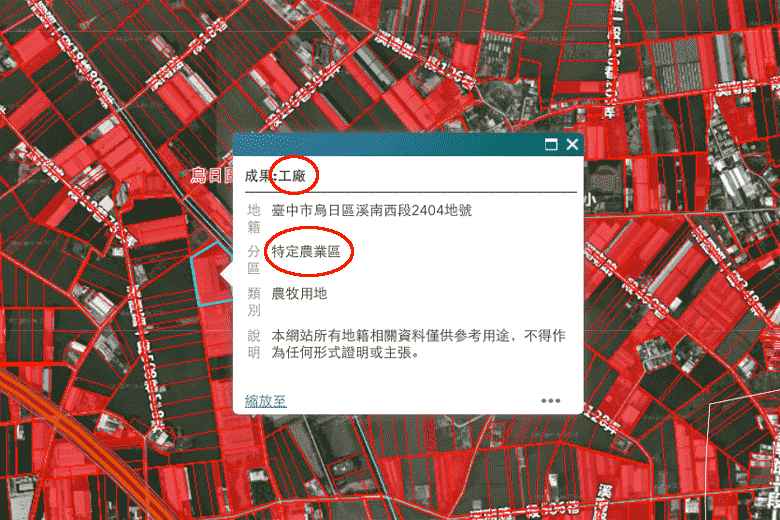


Agricultural and Farmland Resource Inventory Results Query Map Platform
Latest Inventory: 130,000 Illegal Factories on Farmland! Council of Agriculture: Half of Newly Established Illegal Factories to Be Demolished by Year-End; Farmhouses Are the Next Target
For more professional agricultural technology news, please scan the QR code to follow WeChat: NongXunNET

Please cite the source when reposting.