Chiayi County Pioneers Drone Surveys of Oyster Fields, Racing Against Typhoons
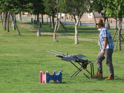
As Typhoon Soudelor bore down menacingly, farmers who depend on the sky for their living all braced themselves for the worst, while the Chiayi County Government, taking advantage of the moment before Soudelor struck Taiwan, sent out drones to photograph the current state of some oyster fields, so as to conduct an experimental comparison for post-disaster damage surveys. Unlike assessing damage to rice paddies, tidal movements mean the drones must be launched within 30 minutes of low tide to capture the condition of the damaged oyster fields, and this technology has shortened what used to take a week of disaster surveying to 3 days, while the imagery captured is also more accurate than rough human estimates.
In the past, calculating oyster rack damage was imprecise, time-consuming and labor-intensive


News Glossary: Fishery Rights
Fishery rights are divided into three types: fixed fishery rights, demarcated fishery rights and special fishery rights. Fixed fishery rights refer to the right of fishers to install fishing gear in a certain body of water to catch aquatic animals; demarcated fishery rights refer to the right, after a certain body of water is demarcated, for fishers to cultivate aquatic animals and plants there, as in the case of the Chiayi County oyster farming zone in this article; and special fishery rights are the most important management tool for Taiwan's coastal fisheries, likewise turning a certain area of water into a fishing ground for fishers to catch and cultivate aquatic animals. Notably, this type of fishery right can only be applied for by fishers' associations or cooperatives; local county and city governments have no authority over it.
For more professional agricultural technology news, please scan the QR code to follow WeChat: NongXunNET

Please indicate the source when reprinting.