What Is the Difference Between a Hurricane and a Typhoon? Explained Clearly in One Article
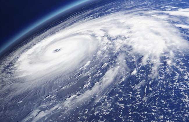
A typhoon refers to a tropical cyclone that forms over vast expanses of ocean in the tropics or subtropics where temperatures exceed 26°C. The word hurricane comes from Hurican, the devil god of Caribbean languages, and refers to a destructive tropical cyclone in the Atlantic with wind speeds exceeding 74 miles per hour. It usually occurs in summer and early autumn, and is often accompanied by thunder and lightning when it arrives. Let's take a look below at the difference between hurricanes and typhoons!
The Difference Between Hurricanes and Typhoons
There is no difference between a hurricane and a typhoon; they are simply called by different names because they occur in different locations. Both hurricanes and typhoons refer to tropical cyclones with wind speeds of 33 m/s or more; they are only given different names because of the different regions where they form. Intense tropical cyclones that form in the Northwest Pacific and the South China Sea are called “typhoons”, those that form in the Atlantic, the Caribbean Sea and the eastern North Pacific are called “hurricanes”, and those that form in the Indian Ocean, the Arabian Sea and the Bay of Bengal are called “cyclones”.
How Do Typhoons Form?
Typhoons originate over tropical seas, where temperatures are high and large amounts of seawater evaporate into the air, forming a low-pressure center. As the pressure changes and the Earth itself rotates, the inflowing air also begins to rotate, forming a counterclockwise-rotating air vortex - this is a tropical cyclone. As long as the temperature does not drop, this tropical cyclone will grow stronger and stronger, eventually forming a typhoon.
How Do Typhoons Develop?
1. gestation stage: After a day of solar radiation, strong cumulonimbus clouds form over the sea surface. The hot air inside these cumulonimbus clouds rises, and the surrounding cooler air continuously flows in to replace it, then rises again upon being heated, and so the cycle repeats, making the air above hot and the air below cold. The water vapor in the hot air above evaporates and expands the range of the cloud band, and the expansion of the cloud band makes this movement even more intense. The continuously expanding cloud cluster is affected by the Coriolis force and begins to rotate counterclockwise, forming a tropical cyclone. The centrifugal force generated by the rotating air inside the tropical cyclone throws the air outward, the air at the center becomes increasingly thin, and the air pressure keeps dropping, forming a tropical depression - the initial stage of a typhoon.
2. development stage: The central pressure of a tropical depression is lower than that of the surrounding environment, so the surrounding air rushes toward the tropical depression and rises upon being heated, supplying the tropical depression with more energy than it outputs. At this point, the air inside the tropical depression rotates even more vigorously, the maximum wind force at the center rises, and the central pressure drops further. When the maximum wind force near the center reaches a certain standard, it will be upgraded to a higher level: the tropical depression is upgraded to a tropical storm, then to a severe tropical storm and a typhoon, and sometimes it can be upgraded to a severe typhoon or even a super typhoon.
3. mature stage: The size of a typhoon depends on the ratio of energy input to output. If the input energy is greater than the output energy, the typhoon will strengthen; otherwise, it will weaken. After a long course of development, a typhoon becomes powerful and gains the ability to cause disasters. If it makes landfall at this time, it will cause major losses.
4. dissipation stage: There are two paths for a typhoon to dissipate. The first is: after a typhoon makes landfall, under the combined influence of ground friction and insufficient energy supply, the typhoon will rapidly weaken and dissipate. The residual cloud system after dissipation can bring prolonged heavy rainfall to a certain area. The second is: the typhoon turns north in the northern part of the East China Sea, and after making landfall in South Korea or passing through the Korea Strait, it transforms into an extratropical cyclone in the Sea of Japan. After transforming into an extratropical cyclone, it dissipates more slowly.